Difficulty
Difficult
Distance
96,0 km
Duration
4 days
Height difference
3540 m
Municipality of departure
PREMIAN
Municipality of arrival
LODEVE
Address
GPS coordinates : 43.5246111 / 2.83109789
Trail
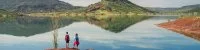
Through the Regional Natural Park of the Haut-Languedoc, this wild itinerary of 2 to 4 days is a treat for the eyes! Discover the Caroux Mountains by walking or running.


Empire of the mouflon, successfully reintroduced in the middle of the 1960s, the Caroux Mountains are characterized by a very steep terrain with a Corsican feel. The reliefs pass quickly from 200 to 1000 m of altitude and are crossed by typical and technical paths. A real balcony on the Mediterranean Sea and the Pyrenees, the route is a feast for the eyes. Here, all the kilometers are to be earned, we are on a real trail terrain, playful and demanding. The rewards of the numerous viewpoints and the diversity of the landscape are all the more appreciated. And to top it all off, you will certainly have the chance to cross the path of the mouflon, master of the place and emblem of the massif.
Mountain
View onto the Pyrenees
Difficult
96,0 km
4 days
3540 m
PREMIAN
LODEVE
GPS coordinates : 43.5246111 / 2.83109789


